


ABC Atlas - Herts And Beds
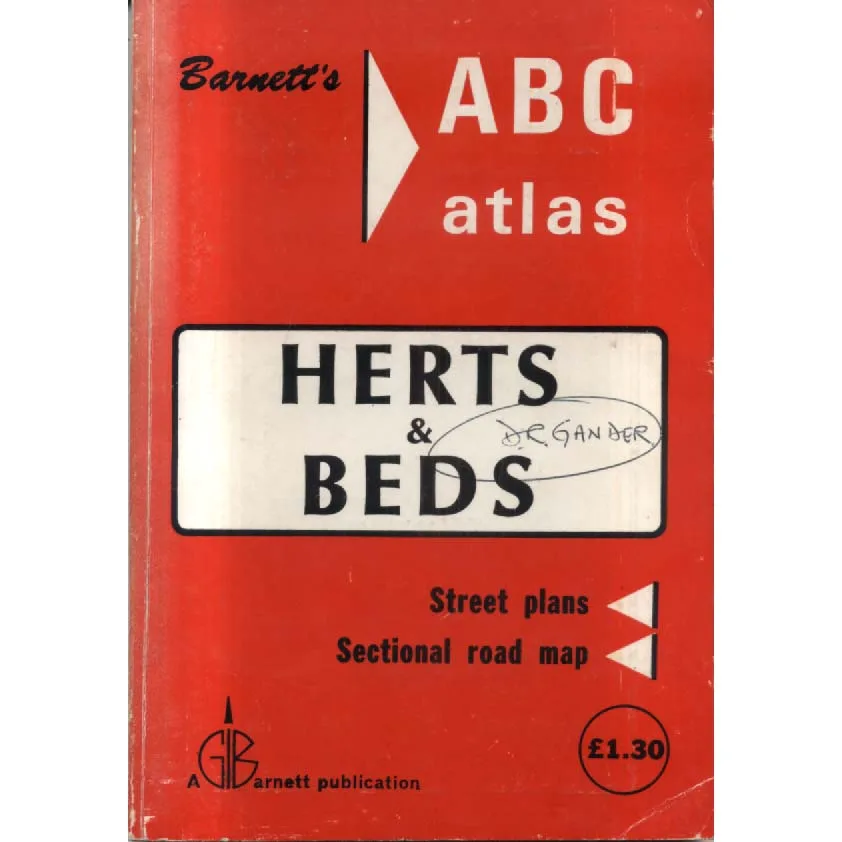
Publisher: GI Barnett
Format: Paperback
ISBN: none
ABC Atlas – Herts and Beds (c.1975)
Edited and compiled by Michael Barnett (G.I. Barnett)
ISBN: None (too cool and too early for such modern nonsense)
Condition: Good
Lovingly offloaded to you by: Crappy Old Books
Before satnav. Before Google Maps. Before your phone started bossing you around at roundabouts. There was this – Barnett’s ABC Atlas – Herts and Beds – a comforting cardboard oracle of Hertfordshire and Bedfordshire, produced by G.I. Barnett & Son, proud creators of large-scale street maps and county atlases since the 1950s. (gillmark.com)
Inside this delightfully analogue artefact you’ll find an entire mini-universe of streets, cul-de-sacs and bypasses, laid out in clear Barnett cartographic style:
-
Street plans for towns across Herts and Beds
-
A big, dramatic fold-out county road map so large it could double as emergency gift wrap
-
Period local adverts quietly insisting you need tyres, removals, insurance and perhaps a fish-and-chip shop you’ve never heard of but now feel strangely loyal to (gillmark.com)
This is the kind of atlas that once lived in glove compartments of beige Cortinas and Austin Maxis, its fold-out map creased along the main escape routes from Luton, Hemel Hempstead, Bedford and the mysterious hinterlands in between. Somewhere on these pages are the roads your parents got lost on in 1978 while insisting they “knew a shortcut”.
And this particular copy? Officially rated Good by the highly scientific standards of Crappy Old Books:
-
The cover: still attached and basically respectable, possibly with minor scuffs that whisper “I’ve been in a car. A real one.”
-
The pages: all present, all legible, with the sort of gentle ageing that says “vintage” rather than “attic tragedy”.
-
The fold-out map: likely to perform its party trick of trying to occupy the entire table, but still perfectly useable for getting from, say, St Albans to Bedford without crossing into a different decade.
No ISBN, of course – this is a pre-barcoded, pre-metadata creature from a simpler era, when a book proved its existence by smelling faintly of paper and petrol, not by being “discoverable in a global catalogue”. G.I. Barnett were busy making maps people actually used, not worrying about how they’d look on an online listing half a century later. (gillmark.com)
Is it still useful today?
That depends.
If you want real-time traffic updates, absolutely not.
If you want to know what a 1970s cartographer thought the universe of Herts and Beds looked like, absolutely yes.
This atlas shows a world caught mid-evolution: bypasses still ambitious, estates still new, town centres determinedly concrete. It’s brilliant for:
-
Local history nerds who want to see how their road looked before it was sacrificed to a ring road.
-
Genealogists tracking down “that house in Dunstable your nan keeps mentioning” using vintage street plans.
-
Map fetishists (you know who you are) who like the feel of real paper geography in their hands.
-
Writers and gamers building 1970s settings who need authentic map detail and period place names without modern retail parks spoiling the vibe.
The irony, of course, is exquisite: you’re buying a carefully compiled, professionally surveyed navigation tool from a dealer called Crappy Old Books. The publisher boasts decades of mapping expertise; we boast a slightly chaotic stock room and a willingness to rehome cartographic orphans.
So if your phone battery dies somewhere between Hitchin and Leighton Buzzard, this atlas might not save you. But it will show you how you might have got home in 1975, which is arguably more interesting.
Adopt this Good-condition ABC Atlas – Herts and Beds from Crappy Old Books and enjoy a time when:
-
“Recalculating route” meant turning the map upside down,
-
“Zoom” meant squinting,
-
And “location services” meant Dad pulling into a lay-by and muttering at a fold-out sheet the size of a small bedsheet.
Crappy Old Books: proudly supplying obsolete navigation technology that’s far too charming to throw away.
Keep browsing: See more Maps books Other books by Michael Barnett
